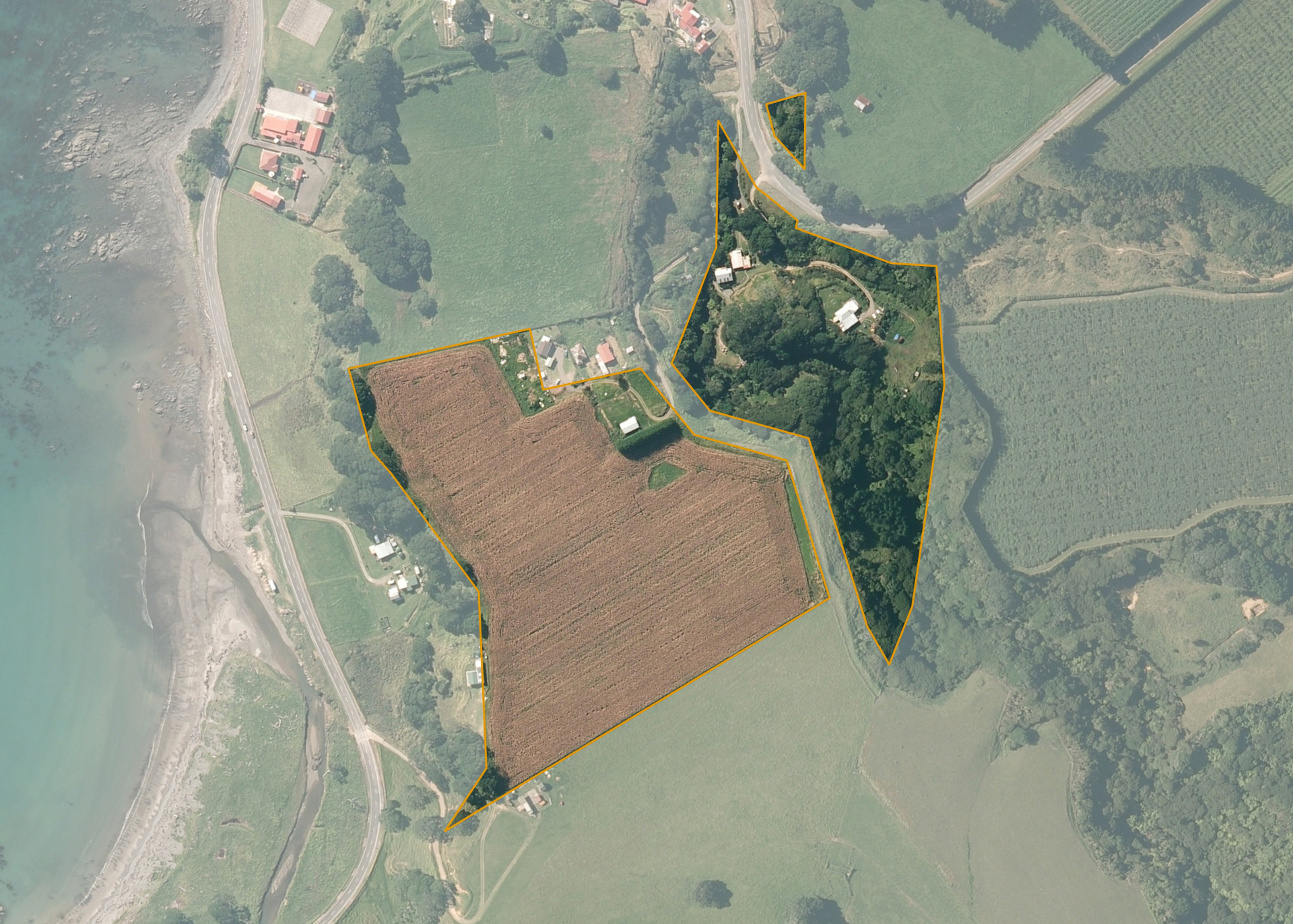
Te Poito 7B2B
Te Poito 7B 2B has a land area of 10.2515 hectares and is located on the southern side of State Highway 35, 3 kilometres south west of Waihau Bay. The land is flat to medium hill in contour, is in close proximity to the coast, and is situated on a terrace above the State Highway. The block can be accessed through a shared access way from State Highway 35, over a 4WD track which includes fording the Tauranga Stream.
The southern severance is currently utilised for maize production.
Land Information
- Land area:
- 10.2515 hectares
- Location:
- 10180A STATE HIGHWAY 35, TE KAHA
- Region:
- Bay of Plenty
- Māori Land Court region:
- Waiariki
- Role of Māori Trustee for this whenua:
- Responsible Trustee
Learn more about the role of the Māori Trustee.
Owner Information
There are 167 people or whānau trusts who have shares in Te Poito 7B2B.
Find individual owners or whānau trusts for this whenua
Tip: Search by first name
If you have a question about this whenua or you want to update your details please contact us.
Find out about upcoming owner hui for this whenuaStay connected with My Whenua
My Whenua is our online service for owners, trustees, whānau and those with a connection to whenua we look after on their behalf.
It’s a way to stay up to date with information about your whenua, including:
- Maps and photos
- Owner reports
- A list of owners
- Minutes of owner hui, and more.