Pukekohatu 7B
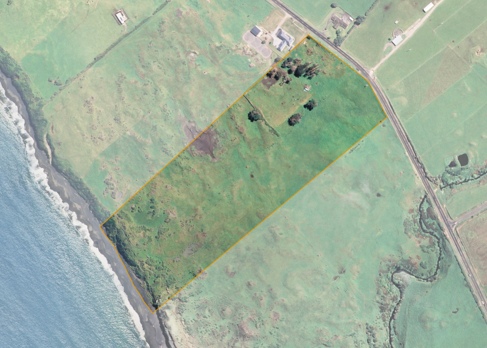
Pukekohatu 7B is a 10.2183 hectare property situated on South Road, State Highway 45, and is approximately 2.2 kilometres south-east of Opunake. The land is flat to easy undulating in contour with steeper stream sidlings and cliffs. The block can be accessed from South Road.
The block is currently leased together with Pukekohatu 6A and 6B. The properties form a 26.76 hectare block, of which, 17.44 hectares is utilised for beef fattening. The balance of the land can be attributed to the retired area.
An area of 4.3ha of the subject property is excluded from the lease. The area is under an occupation arrangement.
Land Information
- Land area:
- 10.2183 hectares
- Location:
- South Road, Opunake
- Region:
- Taranaki
- Māori Land Court region:
- Aotea
- Role of Māori Trustee for this whenua:
- Responsible Trustee
Learn more about the role of the Māori Trustee.
Owner Information
There are 182 people or whānau trusts who have shares in Pukekohatu 7B.
Find individual owners or whānau trusts for this whenua
Tip: Search by first name
If you have a question about this whenua or you want to update your details please contact us.
Find out about upcoming owner hui for this whenuaStay connected with My Whenua
My Whenua is our online service for owners, trustees, whānau and those with a connection to whenua we look after on their behalf.
It’s a way to stay up to date with information about your whenua, including:
- Maps and photos
- Owner reports
- A list of owners
- Minutes of owner hui, and more.