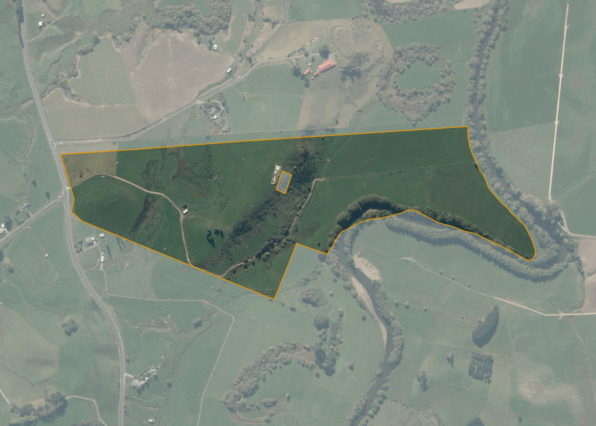
Puketarata 10B2
Puketarata 10B2 is a 24.3 hectare property situated on the eastern side of Kawhia Road/State Highway 39, some 5km from Otorohanga and access is gained from Kawhia Road/State Highway 39
The block is undulating to easy hill on the western side, then rises with a medium hill contour then falling steeply. The Western boundary adjoins the Waipa River.
Puketarata 10B2 is utilised for grazing purposes.
At the highest point on the property an area has been set aside and being used for an urupa.
Land Information
- Land area:
- 24.9691 hectares
- Location:
- Kawhia Road/State Highway 39, Otorohanga
- Region:
- Waikato
- Māori Land Court region:
- Waikato Maniapoto
- Role of Māori Trustee for this whenua:
- Agent
Learn more about the role of the Māori Trustee.
Owner Information
There are 256 people or whānau trusts who have shares in Puketarata 10B2.
Find individual owners or whānau trusts for this whenua
Tip: Search by first name
If you have a question about this whenua or you want to update your details please contact us.
Find out about upcoming owner hui for this whenuaStay connected with My Whenua
My Whenua is our online service for owners, trustees, whānau and those with a connection to whenua we look after on their behalf.
It’s a way to stay up to date with information about your whenua, including:
- Maps and photos
- Owner reports
- A list of owners
- Minutes of owner hui, and more.