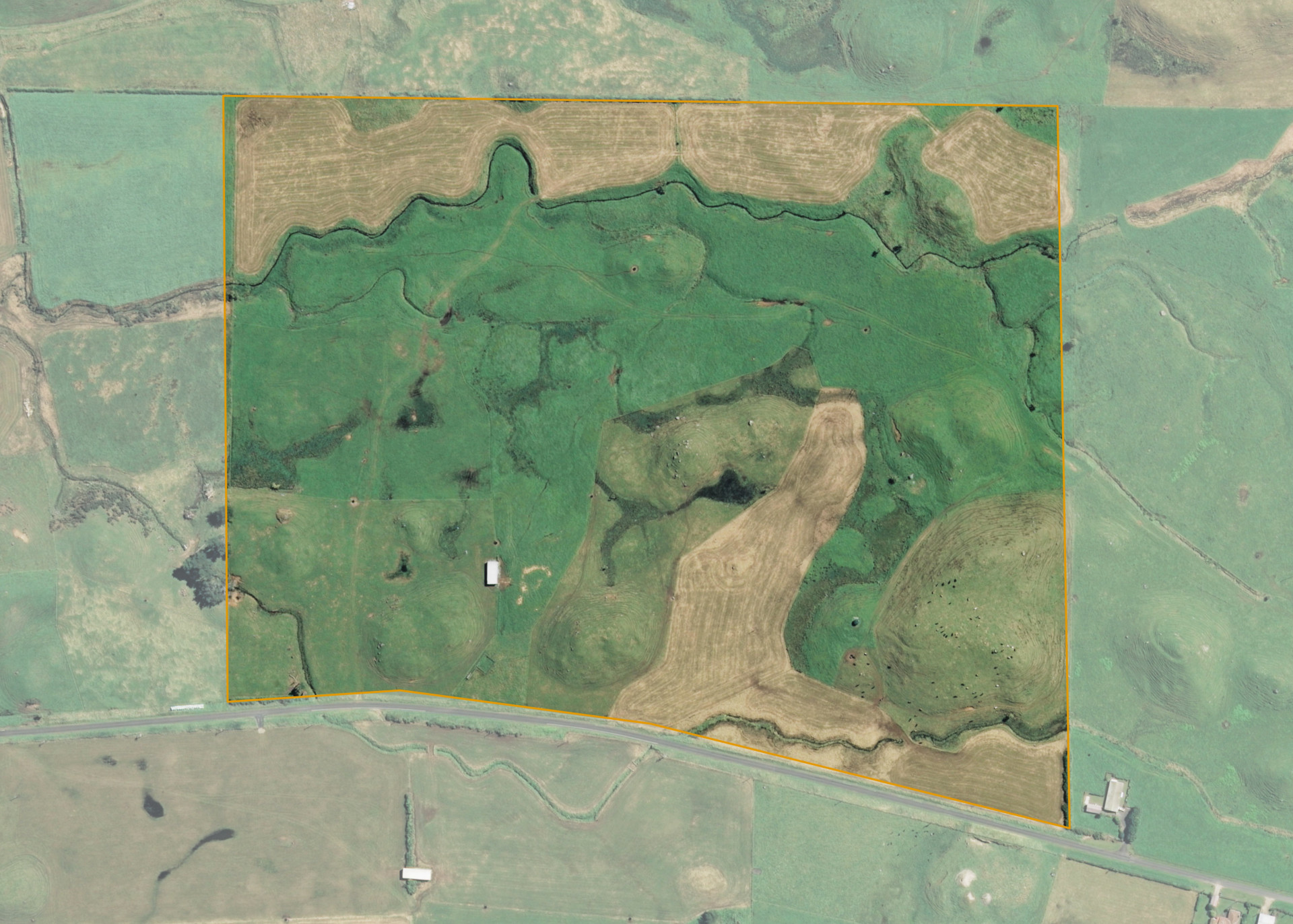
Parihaka 22B
Parihaka 22B is a 24.3064 hectare property situated on the northern side of Wataroa Road, approximately 3 kilometres north-east of Pungarehu. The land is flat to easy rolling in contour with an area of hill at the eastern end of the property. The property is broken by several drains, swampy areas and lahar mounds. The block can be accessed from Wataroa Road.
The effective area, approximately 23 hectares, is currently utilised for dairy run-off/support. The balance of the land can be attributed to drains and swamp.
There is a small set of stockyards, hay barn and a pump shed on the property.
Land Information
- Land area:
- 24.3064 hectares
- Location:
- Wataroa Road, Pungarehu
- Region:
- Taranaki
- Māori Land Court region:
- Aotea
- Role of Māori Trustee for this whenua:
- Responsible Trustee
Learn more about the role of the Māori Trustee.
Owner Information
There are 75 people or whānau trusts who have shares in Parihaka 22B.
Find individual owners or whānau trusts for this whenua
Tip: Search by first name
If you have a question about this whenua or you want to update your details please contact us.
Find out about upcoming owner hui for this whenuaStay connected with My Whenua
My Whenua is our online service for owners, trustees, whānau and those with a connection to whenua we look after on their behalf.
It’s a way to stay up to date with information about your whenua, including:
- Maps and photos
- Owner reports
- A list of owners
- Minutes of owner hui, and more.