Manawatu Kukutauaki 7D 2D 60C
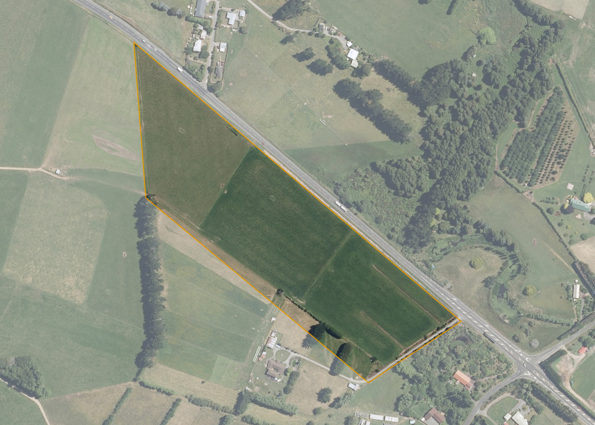
Manawatu Kukutauaki 7D 2D 60C is an 8.0431 hectare property situated on State Highway One, 5 kilometres north of Levin. The block has an open aspect and is flat in contour.
The property can be accessed from State Highway One by the stockyards.
The soils on the block comprise of Levin silt loam.
The effective area 7.8194 ha is currently utilised for dairying in conjunction with the lessee's western adjoining dairy farm.
There is a small set of cattleyards on the property, water is provided from the lessee and whilst the block has no power there are power lines available to the northern boundary.
Land Information
- Land area:
- 8.0431 hectares
- Location:
- State Highway One, 3 Km north of Levin
- Region:
- Manawatu / Whanganui
- Māori Land Court region:
- Aotea
- Role of Māori Trustee for this whenua:
- Responsible Trustee
Learn more about the role of the Māori Trustee.
Owner Information
There are 48 people or whānau trusts who have shares in Manawatu Kukutauaki 7D 2D 60C.
Find individual owners or whānau trusts for this whenua
Tip: Search by first name
If you have a question about this whenua or you want to update your details please contact us.
Find out about upcoming owner hui for this whenuaStay connected with My Whenua
My Whenua is our online service for owners, trustees, whānau and those with a connection to whenua we look after on their behalf.
It’s a way to stay up to date with information about your whenua, including:
- Maps and photos
- Owner reports
- A list of owners
- Minutes of owner hui, and more.