Manawatu Kukutauaki 2D 12A
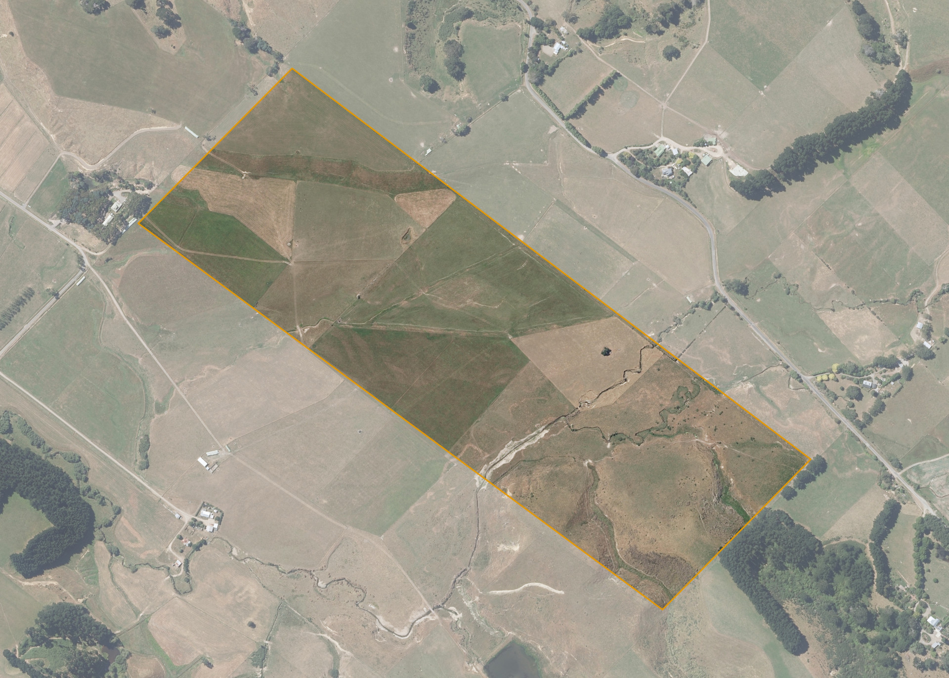
Manawatu Kukutauaki 2D 12A is a 39.8008 hectare property situated on Kara Road, approximately 4 kilometres east of Shannon. The land is flat to easy rolling in contour with a gully at the southern end of the property. The flats have an open aspect while the hillside areas have a predominantly northern aspect. Soils on the property comprise of Tokomaru silt loam.
The block can be accessed from Hennesey Road, with this road only partially formed for around 110 meters off Kara Road. A bulldozed track provides vehicle access up to the terrace flat in the northeastern corner of the property.
The effective area, approximately 39.00 hectares, is currently utilised for Dairy runoff. The balance of the land can be attributed to the swampy watercourse areas.
Land Information
- Land area:
- 39.8008 hectares
- Location:
- 111 Kara Road, Shannon
- Region:
- Manawatu / Whanganui
- Māori Land Court region:
- Aotea
- Role of Māori Trustee for this whenua:
- Responsible Trustee
Learn more about the role of the Māori Trustee.
Owner Information
There are 118 people or whānau trusts who have shares in Manawatu Kukutauaki 2D 12A.
Find individual owners or whānau trusts for this whenua
Tip: Search by first name
If you have a question about this whenua or you want to update your details please contact us.
Find out about upcoming owner hui for this whenuaStay connected with My Whenua
My Whenua is our online service for owners, trustees, whānau and those with a connection to whenua we look after on their behalf.
It’s a way to stay up to date with information about your whenua, including:
- Maps and photos
- Owner reports
- A list of owners
- Minutes of owner hui, and more.